
OIL AND GAS · OPERATORS, MIDSTREAM AND FIELD SERVICES
Unified field monitoring.Oil and gas software for every site.
Your sensors, flow controls and SCADA already collect the data. We connect them to live dashboards, safety alerts and mobile apps your crews rely on every day, so your team sees every site in one place and acts sooner. Our strategy, design and engineering teams own your project from first assessment through ongoing support.
- 20+ years launching production software
- 250M+ downloads delivered
- US-based leads on every team
Book your strategy call
A complimentary 30-minute call with our team to talk through your sites, the systems you run today and where connected data can help first.
WHAT WE HEAR FROM THE FIELD
Your sites already have the data. Your team needs it in one view.
-
Remote sites tracked by hand.
Pumpers drive routes, record readings by hand and enter them into spreadsheets days later, so decisions run on last week's numbers.
-
Safety data in separate systems.
Gas detection, flow controls and inspection records live in different tools, which slows how quickly your team can respond.
-
Insurance and audit requirements.
Carriers and regulators expect proof of monitoring and response, and pulling that report together by hand takes days.
Oil and gas solutions
The strategy, design and engineering teams behind our web, mobile, IoT and AI work, applied to the systems your sites already run.
(01)
Field data assessment and roadmap
STRATEGY · Operators · Midstream · Field services
We review the sensors, SCADA and tools you run today, identify where connected data pays off first, and deliver a technical roadmap your team can act on.
(02)
Remote monitoring and alerts
IOT · Operators · Midstream
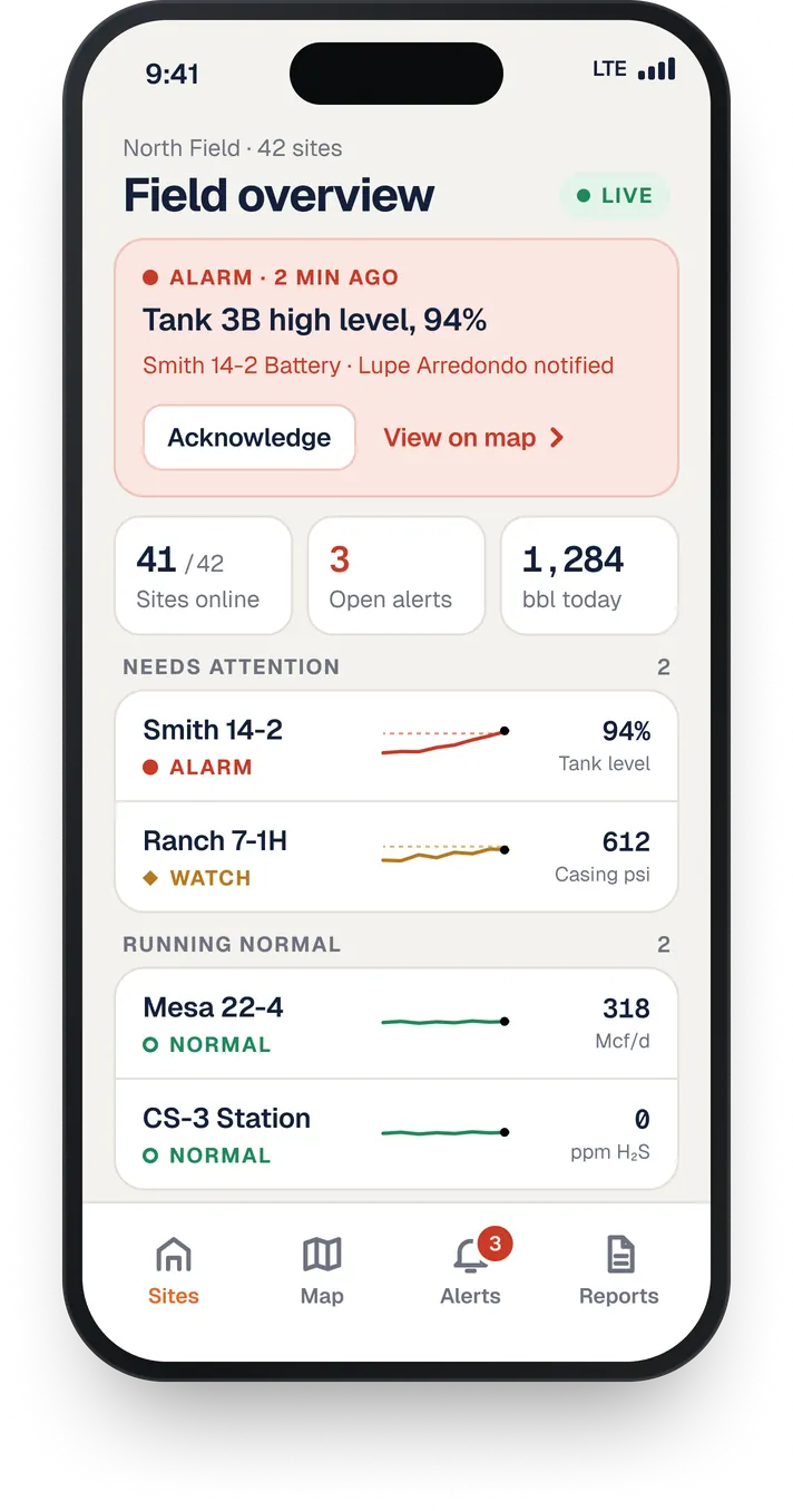
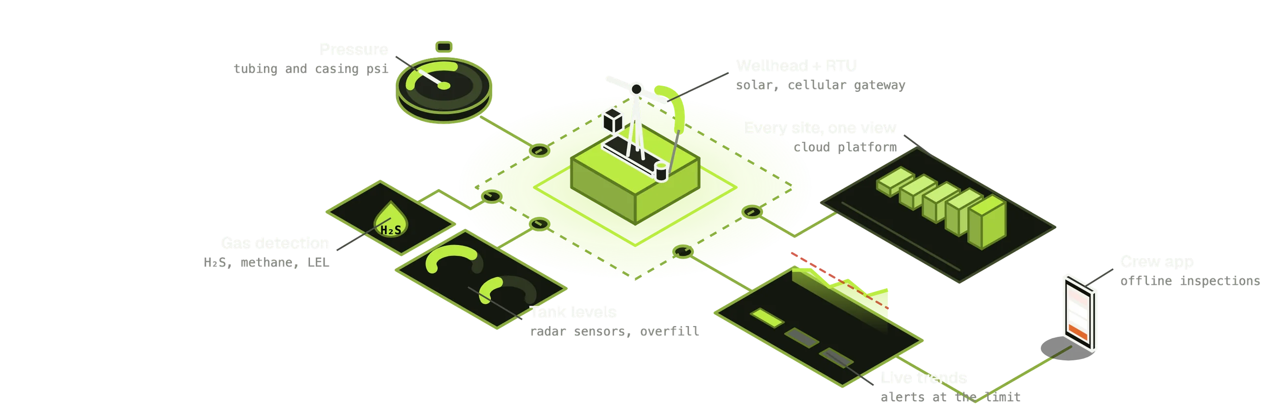
Pressure, flow, tank levels and gas detection stream to one view, with text and app alerts that reach the right person the moment a reading crosses a limit.
(03)
Integration and real-time data
DATA · Operators · Automation partners
We connect the sensors, RTUs and SCADA you already own into one data platform, so the equipment you have keeps working harder for you.
(04)
Field and safety apps
MOBILE · Operators · Safety providers
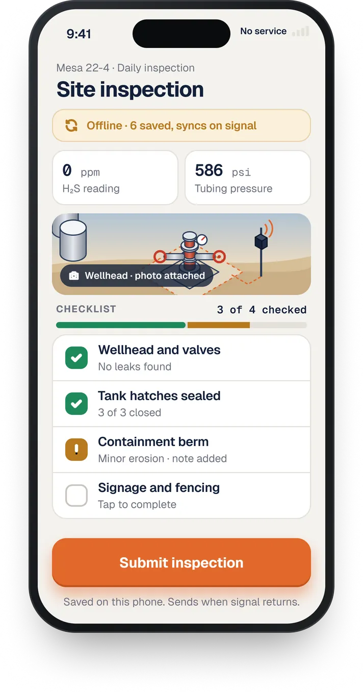
Inspections, incident logs and audit-ready reports your crews complete on site. Apps work offline at the lease and sync as soon as crews get signal.
(05)
Customer and dealer portals
WEB · Equipment makers · Distributors
Ordering, service requests and asset history in one portal, so your customers and distributors get answers without a phone call.
(06)
AI and computer vision
AI · Operators · Inspection teams
Photo-based inspections and machine learning on your sensor data, so your team spots equipment issues sooner.
(07)
Prototypes and pilots
MVP · Operators · Field services
A working dashboard or field app on your real readings in weeks, so your team can test it on site before a full rollout.
(08)
Maintenance and support
SUPPORT · For long-term success
Monitoring, updates and on-call support from the same team that built it, so your systems keep running.
HOW IT CONNECTS
From the wellhead to your phone
We work alongside your hardware and automation vendors to build the software layer that connects them. Security is built in from day one, with device certificates, encrypted over-the-air updates, mutual TLS and role-based access on every dashboard.
GIS AND ASSET TRACKING
Every well, line and truck on one live map.
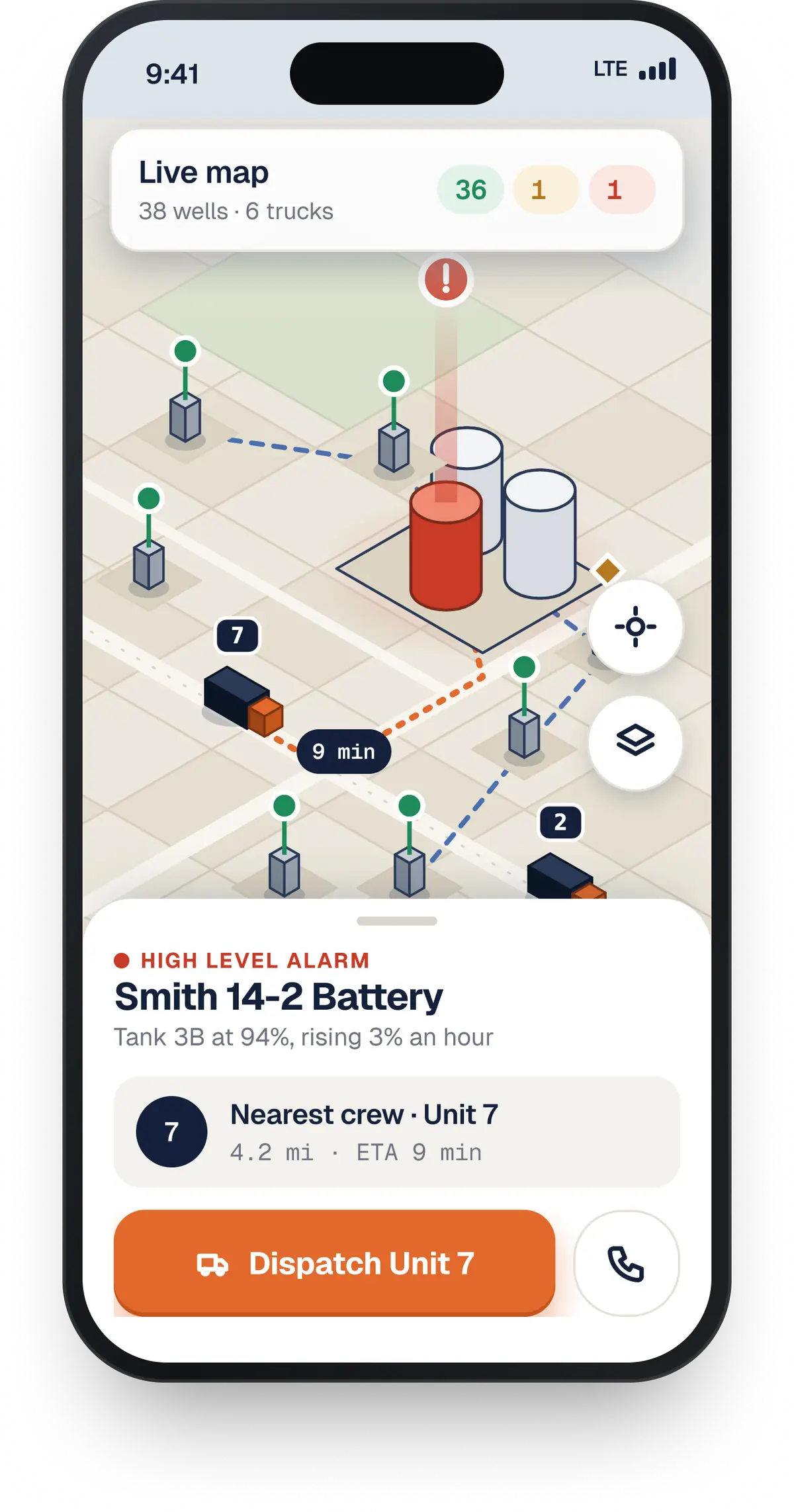
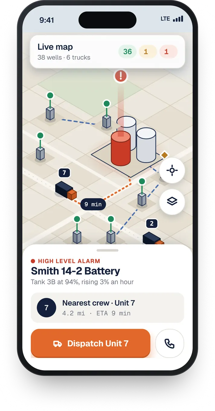
Your wells, tanks, pipelines and crews spread across hundreds of miles. We bring GIS mapping together with your live sensor and SCADA data, so your team sees where every asset is, how it is performing and who is closest to respond.
-
Live asset maps
Wells, tanks, compressors and pipeline segments on one map, each showing its latest readings and alert status at a glance.
-
Crew and fleet tracking
GPS location for trucks and field crews, so dispatch sends the nearest team to a site and pumper routes run shorter.
-
Geofencing and location alerts
Alerts when vehicles enter or leave a lease, when crews arrive on site, and when a reading crosses a limit, tagged to the exact location.
-
Location-based compliance records
Inspections, leak surveys and right-of-way data tied to each site on the map, so audit and regulator reports come together without days of manual work.
-
20+ years of experience.
Your operations run around the clock across remote sites, and the software behind them has to keep up. Metova brings 20+ years of production engineering to the systems your crews, safety teams and auditors rely on every day.
-
Built on what you already run.
We connect the sensors, RTUs, SCADA and automation vendors you already have. You gain live visibility across every site and keep the equipment that's already working.
-
End to end services for your team.
Firmware, connectivity, cloud, dashboards and mobile apps are built by one strategy, design and engineering team. One partner owns how the whole system performs.
-
Ready for remote, high-uptime sites.
Field apps that work offline at the lease, and alerts that reach the right person the moment a limit is crossed.
-
Secure and audit ready.
Encrypted, access-controlled systems built to the standards of regulated industries, with the monitoring records carriers and regulators ask for.
Connected systems already running in the field.
IOT AND GIS · INDUSTRIAL EQUIPMENT
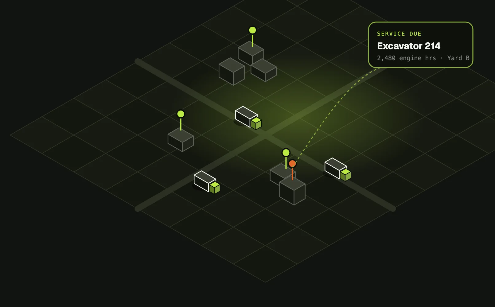
Fleet telemetry and live asset maps for an equipment dealer
A heavy equipment dealer had thousands of machines spread across customer sites and large campuses, and no live view of where they were or when they were due for service. We connected GPS and engine-hour hardware to a cloud platform and synced it with their ERP.
Result: Their team got a live map to find any asset and flag service that's due, plus Bluetooth tracking inside large yards. We later scaled it into a multi-company SaaS platform.
GIS AND MOBILE · LAND AND NATURAL RESOURCES
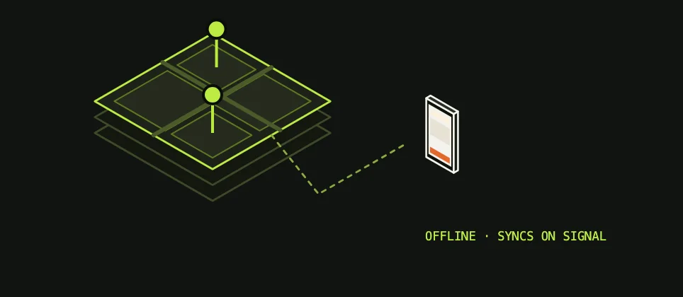
Offline field app with enterprise GIS for land management
A land management company needed field teams to log activity and view property maps in remote areas with little or no signal. We built iOS, Android and desktop apps on their ArcGIS system, with role-based views, that work offline and sync once a connection returns.
Result: Field teams see live map data and log work on site, without needing a signal.
DATA AND SUPPORT · PETROLEUM DISTRIBUTION
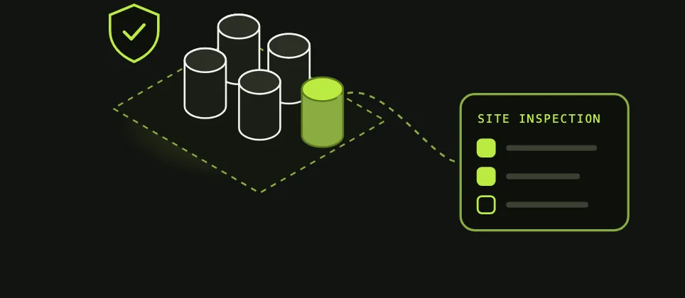
Assessment, modernization and ongoing support for a fuel distributor
A regional petroleum wholesaler was running its pricing, sales and operations portals on aging, unsecured systems. After an on-site assessment, we closed the security gaps, rebuilt the core portals and added a site inspection tool for their safety team. All of it is supported under a multi-year managed services agreement.
Result: Secure, maintainable systems and a safety inspection tool in daily use.
OIL AND GAS STRATEGY CALL · 30 MINUTES
Let's bring your field data into one view.
A complimentary 30-minute call with our team to talk through your sites, the systems you run today and where connected data can help first. You leave with clear next steps.